Kubu Island
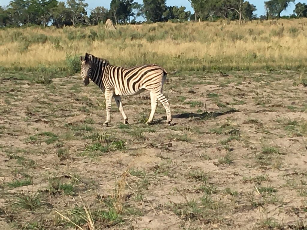
Kubu Island, known locally as Lekhubu, is a granite outcrop roughly a kilometre long rising about ten metres from the southwestern edge of Sua Pan in Botswana’s Makgadikgadi. It is covered in ancient baobabs, ringed by fossilised beaches of wave-rounded pebbles marking the shoreline of a vanished lake, and holds stone tools and ruins spanning an enormous stretch of human history. The whole island is a national monument and a sacred site, managed by a community trust.
What Kubu Island Actually Is
The geology here is genuinely old, and knowing the numbers changes how the place feels when you are standing on it.
The outcrop is granite estimated at around two billion years, which makes it among the older exposed rock a traveller is likely to stand on anywhere. It forms a rough crescent about a kilometre long and rises only around ten metres above the pan surface, which sounds modest until you consider that everything around it is perfectly flat for tens of kilometres.
It is called an island because it was one. When Lake Makgadikgadi filled this basin, Kubu stood in open water, and the fossil beaches terracing its slopes are the physical record of where the waterline sat.
The rocks are pale, coated in fossilised guano left by waterbirds that perched here thousands of years ago when there was water to fish.
In wet years the pan floods around it and Kubu becomes a true island again for a few months, which is worth timing a visit for if the rains have been good.
The white coating on Kubu’s rocks is fossilised bird droppings, left by waterbirds that perched here when this was open lake. It is the most direct evidence you will see anywhere in Botswana that the Makgadikgadi was once full.
The Baobabs and Vegetation of Kubu
What makes Kubu photograph the way it does is the combination of pale rock, white pan and enormous trees.
Baobabs grow directly out of the rock formations, twisted into fantastic shapes by centuries of wind and by growing in almost no soil. Some are estimated at well over a thousand years old.
Star chestnut trees grow among them, and the mix of species on an outcrop this small in country this dry is part of what makes the site unusual.
At sunset the light across the salt turns gold and then red, and the trees silhouette against it. This is the reason most photographers come, and it is worth planning to be there in the evening rather than passing through at midday.
The baobabs are protected along with the rest of the island as a national monument.
Archaeology and the History of Kubu
Kubu is one of the more archaeologically interesting places in Botswana and much of what is here has not been fully explained.
Stone tools have been found on and around the island dating back over a hundred thousand years, some of them predating anatomically modern humans, indicating that people were using this shoreline when the lake still held water.
More recent and more visible is a low stone wall, roughly a metre high, curving in a C shape across part of the island, alongside numerous stone cairns. Their purpose is not settled. Some accounts place them broadly contemporaneous with Great Zimbabwe, which would put them within the last several centuries rather than the deep past. Reaching it usually means a longer circuit such as the 10 day Delta, Pans and Chobe safari.
The island’s name reflects that layered history. Kubu means large rock in Kalanga and hippopotamus in Tswana, while the local Khoe people call the site Ga’nnyo.
The whole island is a declared national monument and is treated as sacred by the communities of the area.
Visiting Respectfully
This matters more at Kubu than at most Botswana sites, and it is worth saying plainly.
The island is a sacred place. Visitors are asked not to remove anything, not to climb on or disturb the stone walls and cairns, not to carve or mark the rocks or trees, and not to litter.
Guided walks can be booked through the community trust, and taking one is the best way to see the site properly and to understand what you are looking at rather than wandering across it.
The trust that manages Kubu was formed in direct response to damage caused by uncontrolled tourism, which is worth knowing when deciding how to behave there.
Leave only footprints is a tired phrase, and at Kubu it is the actual management policy.
Dry season, May to October. Firm tracks, easier access, the pan white and cracked to the horizon. The standard time to visit and the safest for driving.
Wet season, December to March. The pan floods and Kubu becomes a genuine island again for a few months. Spectacular when it happens, with tracks turning to mud and access becoming difficult or impossible.
What to bring. Everything. Water, food, fuel, firewood and cash for camping fees. There are no shops, no services and no water supply anywhere near the island.
The Gaing O Community Trust
Kubu is one of the clearer community tourism arrangements in Botswana, and the story behind it is instructive.
The Gaing O Community Trust was established to represent the community of Mmatshumo village and surrounding settlements, giving them a way to manage and benefit from the natural resources on their land.
It was formed because the community was concerned about damage being done at Kubu Island by uncontrolled tourism. Rather than close the site, they took over its management.
The trust are the custodians of the national monument and run the campsite, with revenue going to the community. Their office is in Mmatshumo village, and bookings are made through them directly.
Guided walks are available through the trust and are worth taking.
Staying here is a direct transfer of tourism spending to the people whose land this is.
Camping at Kubu Island
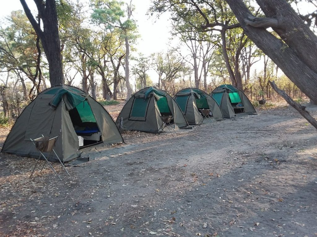
The campsite is the reason many people make the effort, and it is basic in the way Botswana wilderness camping usually is.
Sites sit below the baobabs on the island. There is no entrance fee, with camping charged at around 120 Pula per person per night, payable in cash on site since cards are not accepted.
Facilities amount to a long-drop toilet. There is no water supply, no electricity and no shop, so complete self-sufficiency is required including water, food, fuel and firewood.
Book in advance through the trust, particularly during South African school holidays when the site fills.
Camping under thousand-year-old baobabs on a granite island in the middle of a salt pan, with no light pollution in any direction, is among the more memorable nights available in southern Africa.
Time your arrival for late afternoon rather than midday. The light on the salt at sunset is the whole point of Kubu, and arriving in the middle of the day means several hours of glare and heat before the place becomes what you came for.
Getting to Kubu Island
Access is the main obstacle and it needs planning.
A 4×4 is required, not merely advisable. Tracks are sandy, sometimes overgrown and potentially muddy, and there is no realistic alternative.
From the north, the route leaves the A3 between Maun and Nata, with a track signed for Lekhubu starting near Mabole around 17 kilometres west of Nata. That runs roughly 90 to 95 kilometres of sandy track and takes around four hours. Note that this section of the A3 itself is badly potholed in places.
From the south, the route runs via Mmatshumo village, reached from the A30, following signs for Lekhubu from there.
Access is also possible via Gweta to the north or Letlhakane to the south. The pans are not uniformly flat, with some tracks over higher ground and others crossing seasonal pools.
Carry offline navigation and ask locally about current conditions, since track quality changes with the rains.
Frequently Asked Questions About Kubu Island
What is Kubu Island?
A granite outcrop roughly a kilometre long and around ten metres high, rising from the southwestern edge of Sua Pan in the Makgadikgadi. The rock is estimated at around two billion years old. It is covered in ancient baobabs, ringed by fossilised beaches of wave-rounded pebbles marking the shoreline of the vanished Lake Makgadikgadi, and holds stone tools and ruins. The whole island is a declared national monument and a sacred site for local communities.
How do you get to Kubu Island?
By 4×4 only. From the north, a track signed for Lekhubu leaves the A3 near Mabole around 17 kilometres west of Nata, running roughly 90 to 95 kilometres of sandy track and taking about four hours. From the south, the route runs via Mmatshumo village off the A30. Access is also possible via Gweta or Letlhakane. Carry offline navigation, since tracks are sandy, sometimes overgrown and potentially muddy after rain.
Can you camp at Kubu Island?
Yes, below the baobabs, with sites managed by the Gaing O Community Trust. There is no entrance fee and camping costs around 120 Pula per person per night, payable in cash on site as cards are not accepted. Facilities amount to a long-drop toilet, with no water, electricity or shops, so full self-sufficiency is required including water, food, fuel and firewood. Book ahead, particularly during South African school holidays.
What are the ruins on Kubu Island?
A low stone wall roughly a metre high curving in a C shape across part of the island, alongside numerous stone cairns. Their purpose is not settled, and some accounts place them broadly contemporaneous with Great Zimbabwe. Separately, stone tools found on and around the island date back over a hundred thousand years, some predating anatomically modern humans, indicating people used this shoreline when the lake still held water.
When is the best time to visit Kubu Island?
May to October, the dry season, when tracks are firm and access is straightforward. In wet years the pan floods around the outcrop and Kubu becomes a genuine island again for a few months, which is spectacular but makes the tracks muddy and access difficult or impossible. Whenever you go, aim to arrive in late afternoon, since the light across the salt at sunset is what most visitors come for.
Who manages Kubu Island?
The Gaing O Community Trust, representing the community of Mmatshumo village and surrounding settlements. The trust was formed out of community concern about damage being done at Kubu by uncontrolled tourism, and rather than close the site they took over its management. They are custodians of the national monument, run the campsite, offer guided walks and keep an office in Mmatshumo village where bookings are made.
Booking Your Botswana Trip
The safari companies and tour operators listed on this website put trips like this together for a living and know which camps, guides and routes actually deliver. We are an independent guide to Botswana; we do not book or sell tours ourselves.
When you are ready, arrange your safari, tour or holiday with one of the recognised operators listed here. Tell them your dates and what matters most, and a real person, not a form, will handle the itinerary, park bookings and logistics for you.