Makgadikgadi Salt Pans

The Makgadikgadi is a complex of salt pans covering over 16,000 square kilometres in northeastern Botswana, the dried bed of an inland sea that once held more water than any lake in Africa. Sua and Ntwetwe are the two largest, flat and white enough to be visible from orbit, and standing on them in the dry season offers a horizon with nothing in it at all. The name is commonly translated as vast, lifeless land.
The Lake That Made the Pans
The geology here is genuinely startling and it explains the strangeness of the place.
Lake Makgadikgadi once covered much of northern Botswana, fed by the Okavango and other rivers flowing south from Angola. Estimates of its extent run to around 80,000 square kilometres, with depths of up to 55 metres, making it the largest inland sea Africa has held and larger than Switzerland.
Tectonic movement across southern Africa altered the surface, cutting off the rivers that fed it, and the lake evaporated over a very long period.
What remained is a quilt of salt flats, clay pans and fossilised shorelines, with salt layers running metres deep in places. Relic beaches and old lake terraces are still visible across the region.
Archaeological evidence including stone tools indicates human presence around these shores across an enormous span of time, long before the lake finally dried.
Standing on Ntwetwe in the dry season, there is no feature in any direction. No tree, no rise, no horizon line to fix on. It is the emptiest place most visitors will ever stand.
Sua, Ntwetwe and the Wider Pan System
Makgadikgadi is not one pan but many, separated by sandy desert, and knowing which is which helps considerably.
Ntwetwe Pan is the western of the two great pans and the one most safari camps work from. The Makgadikgadi Pans National Park crosses its western end.
Sua Pan, also spelled Sowa, lies to the east and is the one that floods most reliably, fed by the seasonal Nata, Tutume, Semowane and Mosetse rivers from the east.
Smaller pans surround them, including Kudiakam, Nxai and Kaucaca to the north, with sand dunes, rocky islands and peninsulas breaking up the flats between.
The whole complex covers over 16,000 square kilometres, with the largest individual pan running to around 4,900. That makes it among the largest salt pan systems in the world, though the single Salar de Uyuni in Bolivia is a bigger continuous flat.
No vegetation grows on the pan surfaces themselves. Grassland fringes them, with baobabs and palm woodland along the edges.
The Pans in the Wet Season

Rain transforms the Makgadikgadi into something unrecognisable, and it is a different destination entirely.
After good rain the two largest pans flood, and Sua in particular can become a shallow lake, water lapping at pebble shorelines that are relics of the ancient lake itself.
Flamingos arrive in enormous numbers, running into the tens and occasionally hundreds of thousands. Sua Pan holds one of only two breeding populations of greater flamingo in southern Africa, and the spectacle when it happens is among the great wildlife sights on the continent.
Pelicans, ducks and geese follow the same water. The Nata bird reserve at the pan’s northeastern corner is the established place to see them.
The grasslands around the pans green up and draw thousands of zebra and wildebeest, along with gemsbok, springbok and the predators that follow.
None of this is reliable. It depends on rainfall in a region where rainfall is erratic, and dry years produce none of it.
Activities on the Makgadikgadi Pans

The pans offer experiences that exist nowhere else in Botswana, and most run from camps on the private concessions around them.
Quad biking across the crust when it is firm and dry, riding out onto a surface with no horizon feature in any direction. This is a dry season activity and needs the surface hard.
Meerkat viewing at semi-habituated colonies, where the animals are wild but unbothered by people and, having no elevated ground on an open pan, will occasionally climb a seated visitor for a better view. Seeing the pans alongside the water country is what the 9 day Okavango, Makgadikgadi and Chobe safari is for.
Walks with San trackers, reading the ground in a way that changes how you see it afterwards.
Sleep-outs on the open pan, with bedrolls set on the salt under skies dark enough that stargazing is a listed activity rather than an afterthought.
Game drives, birdwatching, horseback safaris and bush walks are offered depending on the operator, and Kubu Island sits within reach on the edge of Sua.
Dry season, May to October. Firm crust for quad biking, the emptiest views, clear dark skies for sleep-outs and stargazing. Wildlife thin on the pans, concentrated on the Boteti River to the west.
Wet season, December to March. Pans flood, flamingos and pelicans arrive in huge numbers in good years, grasslands green and draw the zebra migration. Quad biking stops and tracks become difficult.
Year round. Meerkat colonies, San tracking walks, sleep-outs and stargazing all operate whatever the season, which means a Makgadikgadi leg is rarely wasted.
Driving on the Salt Pans
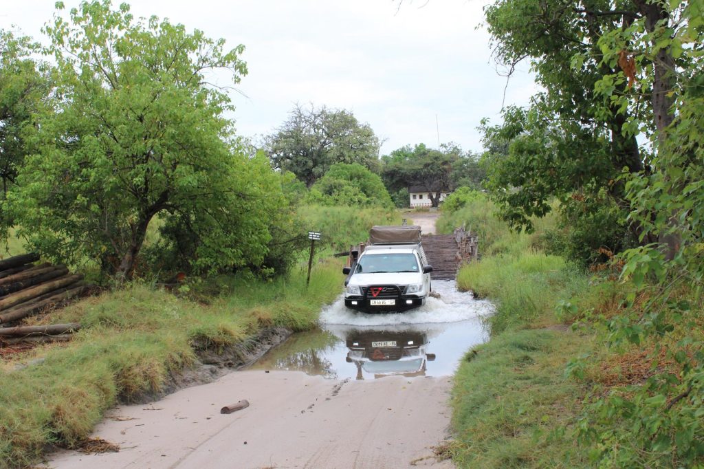
This deserves its own treatment because it is the one place in Botswana where the ground itself is the hazard.
In the dry months from roughly June to October the crust is firm enough to drive on designated routes, and this is when quad biking operates.
After rain the surface becomes treacherous. A vehicle breaks through the crust into the mud beneath, and recovering it in the middle of a pan with no solid ground to winch against and nobody within many kilometres is a serious situation rather than an inconvenience.
People have died on these pans after becoming stranded. That is not a scare tactic, it is the reason guided operators handle pan excursions themselves rather than pointing guests at a track.
Navigation is the second problem. With no features in any direction, a wrong heading is not obvious until it has taken you a long way.
Do not drive onto the pans independently without local guidance, current conditions and a satellite phone.
Kubu Island and the Landmarks of Sua
A handful of features rise from the flats and they are among the more atmospheric places in Botswana.
Kubu Island is a rocky outcrop on the southwestern edge of Sua Pan, covered in ancient baobabs and fossilised beach terraces that mark the ancient shoreline. Camping is permitted there with nothing beyond a long-drop toilet. It carries cultural significance and there are ruins on the island.
Baines’ Baobabs stand on the edge of Kudiakam Pan to the north, seven trees painted by the Victorian artist Thomas Baines and looking much the same today, since baobab girth increases by around a millimetre a year.
Other islands and peninsulas break the flats across the system, most of them unvisited.
These landmarks are worth planning a route around, since on a surface this featureless they become the entire structure of a day.
Conservation Pressures on the Makgadikgadi
Two issues shape the future of the pans and both are worth knowing about.
Veterinary cordon fences, built to separate livestock from wildlife and control disease, historically cut across the migration routes and caused mass die-offs in drought years when animals could not reach water. Fence realignment and removal have improved connectivity considerably, with the removal of a major fence along the Boteti River making a substantial difference.
Soda ash mining at Sua Pan, adjacent to the protected areas, raises continuing questions about water extraction, chemical pollution and habitat disturbance.
Camps in the area fund conservation programmes aimed at keeping migration corridors open between the Boteti, the pans and Nxai Pan, so staying at those properties contributes directly.
The two things people most want here happen in opposite seasons. Quad biking needs a dry firm crust, flamingos need a flooded pan. Decide which you actually came for, or split the difference with April or November.
Frequently Asked Questions About the Makgadikgadi Salt Pans
How big are the Makgadikgadi Salt Pans?
The complex covers over 16,000 square kilometres of the Kalahari Basin, with the largest individual pan running to around 4,900 square kilometres. The two biggest are Sua, also spelled Sowa, in the east and Ntwetwe in the west, with smaller pans including Kudiakam, Nxai and Kaucaca to the north. It is among the largest salt pan systems in the world, though Bolivia’s Salar de Uyuni is a larger single continuous flat.
Can you see flamingos at the Makgadikgadi Pans?
In wet years, in enormous numbers. When Sua and Ntwetwe flood after good rain, flamingo numbers can run into the tens and occasionally hundreds of thousands, and Sua Pan holds one of only two breeding populations of greater flamingo in southern Africa. Pelicans, ducks and geese arrive with them, and the Nata bird reserve on the northeastern corner is the established viewing point. It depends entirely on rainfall and does not happen in dry years.
Is it safe to drive on the Makgadikgadi Pans?
Only in the dry months, on designated routes, and preferably with local guidance. Between roughly June and October the crust is firm enough to carry a vehicle. After rain the surface becomes treacherous, vehicles break through into mud beneath, and recovery in the middle of a pan with nothing to winch against is extremely difficult. Navigation is a second hazard, since there are no features in any direction. People have died after becoming stranded here.
What is Kubu Island?
A rocky outcrop on the southwestern edge of Sua Pan, covered in ancient baobabs and ringed by fossilised beach terraces marking the shoreline of the vanished lake. It carries cultural significance and holds ruins. Camping is permitted with nothing beyond a long-drop toilet, so complete self-sufficiency including all water is required. It sits outside the national park boundaries and is one of the more atmospheric places in Botswana.
What was Lake Makgadikgadi?
An ancient inland sea that once covered much of northern Botswana, fed by the Okavango and other rivers flowing south from Angola. Estimates put it at up to 80,000 square kilometres and as much as 55 metres deep, making it the largest inland sea Africa has held and larger than Switzerland. Tectonic movement cut off the rivers that fed it and the lake evaporated, leaving salt flats, clay pans, fossilised shorelines and salt layers metres deep.
When is the best time to visit the Makgadikgadi Salt Pans?
It depends what you want, and the two answers conflict. December through March brings flooded pans, flamingos in good years, green grassland and the zebra migration, but quad biking stops and tracks become difficult. June through October gives a firm dry crust for quad biking, the emptiest views and the clearest skies for sleep-outs, with wildlife thin and concentrated on the Boteti River instead. April and November split the difference.
Booking Your Botswana Trip
The safari companies and tour operators listed on this website put trips like this together for a living and know which camps, guides and routes actually deliver. We are an independent guide to Botswana; we do not book or sell tours ourselves.
When you are ready, arrange your safari, tour or holiday with one of the recognised operators listed here. Tell them your dates and what matters most, and a real person, not a form, will handle the itinerary, park bookings and logistics for you.