Kalahari Desert Guide
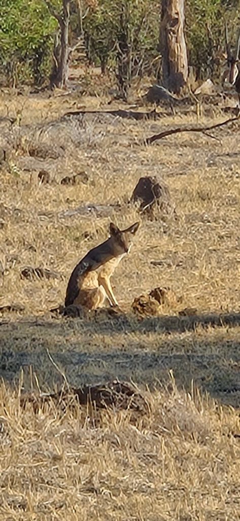
The Kalahari is a semi-arid sandy savanna covering roughly 900,000 square kilometres across Botswana, eastern Namibia and South Africa’s Northern Cape, and it is not a true desert at all, receiving between 200 and 500 millimetres of rain a year. Its red sand reaches depths of over 200 metres in places, making it one of the largest continuous sand surfaces on earth. Botswana sits almost entirely within it, which is why the country’s wildlife areas behave as they do.
Why the Kalahari Is Not Really a Desert
Getting this right changes what you expect to see, and most visitors arrive with the wrong picture entirely.
A true desert receives under 250 millimetres of rain annually. The Kalahari receives between 200 and 500, varying from under 110 in the arid southwest to over 500 in the north. Geographers classify it instead as a semi-arid savanna, arid savanna or semi-desert rather than a desert proper.
What that means on the ground is grass, thorn trees, scrub and seasonal flowers rather than bare sand. Waist-high golden grasses running to the horizon, dwarfed trees, and after rain green country scattered with wildflowers.
The dunes exist, but they are ancient parallel ridges stabilised by vegetation, separated by flat interdune valleys sometimes called streets. They are nothing like the shifting dunes of the Namib or the Sahara.
The name comes from the Tswana word Kgala, meaning the great thirst, or Kgalagadi, meaning a waterless place. That refers to the absence of permanent surface water rather than the absence of rain.
The Kalahari has no permanent surface water across vast areas and yet supports lion, cheetah, gemsbok and giraffe. Water is the thing it lacks, not rainfall.
The Geography of the Kalahari

The desert forms a basin-like plain on the interior plateau of southern Africa, sitting at around 900 metres above sea level or higher throughout.
It runs roughly 1,600 kilometres north to south and around 1,000 kilometres east to west. It occupies almost all of Botswana, the eastern third of Namibia and the northernmost part of South Africa’s Northern Cape, merging with the Namib in the southwest.
The surface is featureless and gently undulating, with bedrock exposed only in occasional low hills called kopjes. Three surface types dominate: sand sheets, longitudinal dunes and pans, known locally as vleis. For a night-by-night plan of the desert, see our Kalahari itinerary.
The red colour comes from iron oxide in the sand, deposited over millions of years by ancient river systems and wind.
Beyond the desert proper lies the wider Kalahari Basin, an endorheic depression covering considerably more ground and reaching into Angola, Zambia and Zimbabwe, within which the Okavango Delta and the Makgadikgadi pans both sit.
Sources give the basin area anywhere from around 725,000 to 2,500,000 square kilometres depending on how it is defined.
Water, Pans and the Kalahari’s Great Features
The Kalahari’s most celebrated places exist because of how water behaves in sand this deep.
The Okavango Delta is the clearest example. The Okavango River flows from the Angolan highlands into the Kalahari and is entirely absorbed, fanning out across the sand until it evaporates and seeps away without ever reaching the sea. The Delta exists precisely because Kalahari sand is porous enough to swallow a river.
The Makgadikgadi pans are what remains of an ancient super-lake that once covered much of northern Botswana before tectonic movement cut off its rivers.
Fossil river valleys run through the Central Kalahari, including Deception Valley, marking watercourses that stopped flowing thousands of years ago.
Seasonal pans across the whole region fill after rain and become temporary oases, which is what drives the wildlife movements the Kalahari is known for.
The Okavango is the region’s only genuinely permanent river.
Wildlife of the Kalahari

The desert supports an unexpected range of species, all built around the need to survive without drinking regularly.
Black-maned Kalahari lions are the emblematic predator, ranging widely across open country. Cheetah do well in the terrain, and brown hyena, hard to find elsewhere in Africa, is resident here.
Gemsbok are the definitive Kalahari antelope, able to survive without surface water by extracting moisture from plants and tolerating high body temperatures. Springbok, eland, red hartebeest, kudu and giraffe all occur, with wildebeest and zebra moving seasonally. The contrast between sand and floodplain is the whole point of the 7 day Delta and Kalahari safari.
The smaller species are what repeat visitors come back for: meerkats, bat-eared fox, aardwolf, aardvark, honey badger, caracal, African wildcat, black-footed cat, pangolin, porcupine and springhare.
Birdlife includes kori bustard, secretary bird, and large raptor numbers made easy to see by the open country.
The wetter north supports greater variety than the drier south.
Northern Kalahari. Wetter and more varied, holding the Okavango Delta, the Makgadikgadi and Nxai Pan. Dry forests, savanna and salt lakes, with the greatest wildlife diversity.
Central Kalahari. The Central Kalahari Game Reserve at 52,800 square kilometres, plus Khutse to its south. Fossil valleys, black-maned lions, gemsbok and genuine remoteness.
Southern Kalahari. Driest and most sparsely vegetated, running into the Kgalagadi Transfrontier Park shared with South Africa and including Mabuasehube. Red dunes and dry riverbeds.
The San and the Kalahari
The Kalahari is the ancestral homeland of the San, and their presence here is measured in tens of thousands of years rather than centuries.
The San, also known as Bushmen or in Setswana as Basarwa, have lived across this country as nomadic hunter-gatherers for at least twenty thousand years by most estimates, representing one of the oldest continuous cultures on earth. Their languages use click consonants built into ordinary words.
The Central Kalahari Game Reserve was established as much to protect that way of life as the wildlife, though communities were later relocated out of the reserve in a process that a Botswana court ruled unlawful and that remains contested.
The Tsodilo Hills in the northwest hold over 4,500 rock paintings, the highest concentration anywhere in the world, and are a UNESCO World Heritage Site. The San call them the Mountains of the Gods.
Several lodges employ San guides, and tracking walks with them are the most direct way a visitor meets that knowledge.
What those walks demonstrate is not folklore but working competence. A tracker reads which animal passed, how long ago and in which direction from marks a visitor would step over without noticing, identifies which roots hold water and which plants treat which ailment, and lights a fire without matches because that is a practical skill rather than a demonstration. Guests consistently describe it as the part of a Kalahari trip that stays with them longest, above the lions. On the north-western edge of the sands the Gcwihaba Caves cut down into old dolomite.
Visiting the Kalahari in Botswana

Botswana holds the greatest share of the Kalahari and the widest choice of ways to see it.
The Central Kalahari Game Reserve is the largest protected area, at 52,800 square kilometres, with Khutse adjoining it to the south and reachable in a day from Gaborone. The Kgalagadi Transfrontier Park in the southwest is shared with South Africa and includes Mabuasehube. Nxai Pan and Makgadikgadi Pans National Parks sit in the north.
Fly-in camps operate in and around the Central Kalahari and on the pans. Mobile camping safaris cover the desert overland at far lower cost. Self-drive is possible for the genuinely experienced.
Timing inverts the rest of Botswana. December through April is peak, when rain greens the fossil valleys and draws in game that has been dispersed for months. The dry months deliver thin game and cold nights, with winter temperatures dropping below freezing.
Pack for a temperature range that surprises people. Kalahari summer days push into the high thirties while winter nights fall below freezing with frost on the ground, and both happen in country most visitors picture as uniformly hot.
Frequently Asked Questions About the Kalahari Desert
How big is the Kalahari Desert?
Around 900,000 to 930,000 square kilometres, making it the second largest desert in Africa after the Sahara and among the largest in the world. It runs roughly 1,600 kilometres north to south and about 1,000 kilometres east to west, occupying almost all of Botswana, the eastern third of Namibia and the northernmost part of South Africa’s Northern Cape. The wider Kalahari Basin covers considerably more ground and reaches into Angola, Zambia and Zimbabwe.
Is the Kalahari a real desert?
Not by the standard definition. True deserts receive under 250 millimetres of rain a year, while the Kalahari receives between 200 and 500, ranging from under 110 in the arid southwest to over 500 in the north. Geographers classify it as a semi-arid savanna or semi-desert. What it genuinely lacks is permanent surface water across vast areas, which is what the name means: Kgala, the great thirst, or Kgalagadi, a waterless place.
What wildlife lives in the Kalahari?
Black-maned Kalahari lions are the emblematic predator, alongside cheetah and brown hyena, which is difficult to see elsewhere. Gemsbok are the definitive antelope, surviving without surface water by extracting moisture from plants. Springbok, eland, red hartebeest, kudu and giraffe occur throughout. The smaller species draw repeat visitors: meerkats, bat-eared fox, aardwolf, aardvark, honey badger, caracal, black-footed cat and pangolin. The wetter north holds greater variety than the drier south.
Why is the Kalahari sand red?
Iron oxide. The sand was deposited over millions of years by ancient river systems and wind action, and reaches depths of over 200 metres in places, making the Kalahari one of the largest continuous sand surfaces on earth. The dunes are ancient parallel ridges stabilised by vegetation rather than the shifting dunes of the Namib or Sahara, separated by flat interdune valleys sometimes called streets.
How does the Okavango Delta relate to the Kalahari?
The Delta exists because of Kalahari sand. The Okavango River flows from the Angolan highlands into the Kalahari Basin and is entirely absorbed, fanning out across the porous sand until it evaporates and seeps away without reaching the sea. That geological quirk creates one of Africa’s most productive ecosystems in the middle of otherwise semi-arid country. The Makgadikgadi pans nearby are the remains of an ancient super-lake fed by the same system before tectonic movement cut it off.
When is the best time to visit the Kalahari?
December through April, which inverts the calendar for the rest of Botswana. Summer rain greens the fossil valleys and grasslands, drawing in game that has been dispersed for months, and predator sightings peak as herbivores concentrate on the best grazing. The dry season from May to October delivers thinner game across enormous distances, though nights turn cold enough for frost and the emptiness has its own appeal.
Booking Your Botswana Trip
The safari companies and tour operators listed on this website put trips like this together for a living and know which camps, guides and routes actually deliver. We are an independent guide to Botswana; we do not book or sell tours ourselves.
When you are ready, arrange your safari, tour or holiday with one of the recognised operators listed here. Tell them your dates and what matters most, and a real person, not a form, will handle the itinerary, park bookings and logistics for you.